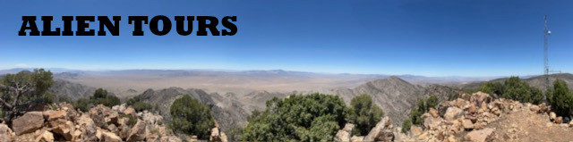
Second ascent to Tikaboo Peak, June 22, 2024.
Made it to Tikaboo Peak again, my second time, another solo hike. Here is the time break down, it is a solid one hour drive to the trail-head from Alamo. I drove aggressively to get a best case time, so the drive is at least an hour. Hiking up, with four rest stops took me one hour and 44 minutes. My phone told me it was a 1.9 mile hike from trail-head to the peak. Hiking back I took no breaks and made it back in just under an hour. I hung out at the peak for a while, the whole experience was about five and a half hours, my first attempt was six and a half hours. Now here are my notes from the trek:
The first quarter is a pleasant uphill climb on a red shale path, at the top of that hill is a fire ring and tent. This portion could be driven by an experienced off road driver. I parked at the bottom of the hill and it took me just under 10 minutes to hike up. Now the path turns right, between and through trees.
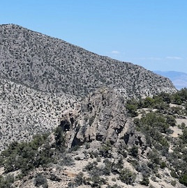
 From here it is trees and gravel, this is a grueling, uphill climb. Easy to get lost here. If you think you’re lost, check (Gaia) GPS. Don’t simply say, “oh, the trail is that way.” Stare at the GPS app, walk in the direction of the trail, when back at the trail, rest easy. Looking around I see no landmarks, just hills and trees. A person could get desperately lost out here. I’m almost halfway, and take my second rest stop.
This hike I brought hiking sticks, they are great, next time I’ll try wearing gloves for a better grip. This is perhaps the toughest portion of the trail. It’s almost straight up on loose gravel. After 51 minutes on the trail, I’m a solid halfway to the peak, I take break number three.
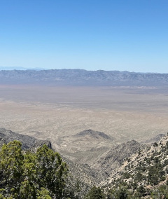
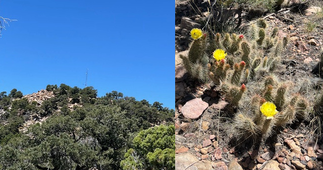
Rest stop number four was at the top end of that uphill climb, we are rewarded with an amazing view, a huge valley stretching out before us. To the right we can see the weather station at Tikaboo Peak. Also, the trail is now a pleasant plateau trek. At the base of Tikaboo Peak is another campsite with fire ring and tent. The trail is hard to follow, but the direction is clear; straight up the mountain peak. I found a shaded spot to rest before my final ascent. Was that five rest stops? Perhaps. I’m at least ¾ of the way. Feeling good.
I am at the peak, the trek up took 1 hour 44 minutes. According to my phone I hiked 1.9 miles. Beautiful clear day, about 79 degrees, gentle breeze. Last time I was here there was a swarm of ladybugs. Today no critters. Can see Area 51 with naked eye.
 The downward journey is no picnic. Stay on the trail! I did better this time, but still relied on Gaia GPS to keep me on track. There is rock landmark to help guide a way, then the plateau. Soon you find youself in a downward plunge, never ending. You might think it’s coming to an end up around that bend, but no, it’s not, it goes on and on on loose gravel, relying on hiking sticks to keep from falling and rolling down this incline. So it goes, on and on. Finally you’ll reach the red path, which I hit at the 51 minute mark. I took no breaks on the journey down. The red shale path feels like a victory walk, until it starts to decline, is this the final boss level!? Nothing like the earlier decline, but don’t get comfortable yet, it’s a downhill walk all the way to the trail head. I made it there in just under an hour.
Previous First ascent to Tikaboo Peak, May 30, 20204.
Next Third ascent to Tikaboo Peak, July 19, 20204.