Third Time to the Top - Tikaboo Peak, July 19 2024
Driving from Alamo to Tikaboo Peak trail-head was 1 hour and 20 minutes. The Hike up was 1 hour and 50 minutes, going down took an hour. This is not an easy hike. Round trip is a solid 3 mile hike. This journal entry breaks the hike into three sectors, the second being the most challenging. My strategy is to take my time, take rest breaks, relax and breathe.
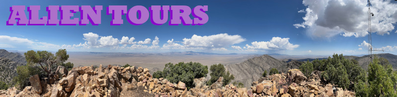
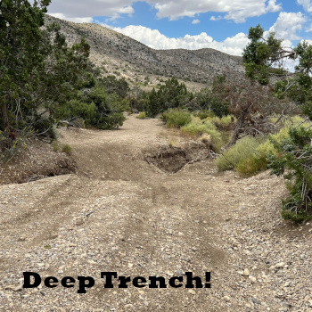 In addition to seeing Area 51, completing this hike gives a great sense of accomplishment, an incredible view, a feeling of being ‘on top of the world’, and cool temperatures in the summertime. From Alamo, Nevada, the journey will take about six hours, and requires an off road vehicle. There is a trench about 3 to 4 miles from the trail-head; that is the biggest driving obstacle (see picture).
Animals you might see along the way include: turtle, lizard, bird, deer, ram, chipmunk, ladybug, fly, cow, bobcat. Mountain lions are also said to be out there, though I’ve never seen one. My first trek was sans hiking sticks. Hiking sticks, however, are a big help on this trail, as a bonus they give your arms, as well as legs a good workout.
The first portion of the trail, Sector 1, takes about 8 minutes and is a fairly easy accent along a red shale trail that is wide enough to drive up. My preference is to park at the trail-head and walk up, as it is a good warm up for what becomes the toughest part of the trail, Sector 2.
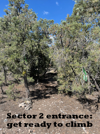 At the top of the red shale trail, there is a sharp right between two trees (see picture). This begins Sector 2, a serious 33 to 51 degree incline, even steeper still. The trail is loose gravel running near a ledge with views of numerous mountain ranges in the distance. There are trees along the way to provide shaded rest areas. About 10 minutes in Sector 2, I am ready for a break. My thoughts include, take a break as needed, no need to push through this hike, relax in a shaded spot and enjoy the serenity.
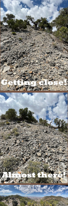 Sector 2 seems to go on forever. There are two trees that make good landmarks to let you know, “you are close to the top of the gravel grind!” The second tree is seen from the first and the apex is seen from the second. At the apex a wide valley comes into view (see pictures).
Once at the top it’s a fairly level, and sometimes downward hike. The Tikaboo Peak weather station can be seen from here. Follow the trail as it leads toward the weather station, it will wrap around the left of a unique boulder - rock landmark, jutting out of this ridge. Once past that boulder - rock the trail lingers down to a fire ring campsite. Today a camp chair was set up, I took a seat, deciding this is a good place to start sector 3.
I’m feeling good. Sector 3 is steep, but the excitement of knowing I’m almost at Tikaboo Peak makes it bearable. This is a 20 to 30 minute, mostly uphill hike with a couple level spots. The terrain is now bigger red rocks and more trees. This being my 3rd time here, I was able to stay on the trail for a while, but did lose it. Fortunately losing the trail is not a big problem, as the main objective is to climb to the top, soon the weather station comes into view and now just hike in that direction.
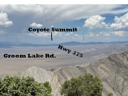
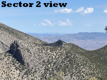
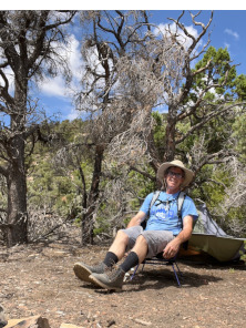
At the top, enjoy the view. This day had beautiful puffy white clouds. I found a shady nook to make a journal entry. My cell phone had a strong signal at the top. Area 51 is visible to my naked eye. Other things to look for include: Bald Mountain, Mount Charleston, Mount Irish, Coyote Summit, and Badger Mountain. Highway 375 (Extraterrestrial Highway) and Groom Lake Road are clearly visible.
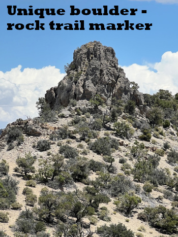 This is an easy trail to get lost on, however my confidence is growing and I was able to return to the trail-head with no problems. If you get lost returning through sector 3, just look for that unique boulder - rock jutting from the adjacent peak, walk toward it, the trail back leads around the right side of that boulder - rock (see picture). Hiking back down through Sector 2, the trail is relatively clear. Just remember Sector 2 seems to be never ending, and when hiking down through the loose gravel, each step is precarious. You might think the end is up around this or that corner, but no, it isn’t. The red shale trail of Sector 1 is a welcome sight. The trail-head is near. Driving back I take a road that cuts through an almost magical Joshua Tree forest with bubbling rocks and steep cliffs. Loving it.
Previous Second ascent to Tikaboo Peak, June 22, 2024.
Next August 1, 2024 Hike to Tikaboo Peak.